Our Services
Comprehensive surveying solutions for all your needs
Industrial Surveying
Icon Surveys Group specializes in high-precision, complex industrial surveying — providing complete geomatics solutions for the most demanding construction environments. Our team has extensive experience delivering construction layout, piling, anchor bolt, and foundation surveys, as well as comprehensive Quality Assurance (QA) and as-built verification programs that ensure absolute accuracy at every stage of the build.
- Concrete Foundations
- Anchor Bolts
- Piling
- Control Survey
- As-Built Surveys
- High Precision Leveling
- 3D Laser Scanning
- LFM Point Cloud Conversions


Topographical / Mining
Providing specialized surveying services tailored to the unique needs of mining operations, major site development projects, and land management initiatives. Our expertise ensures precise data, reliable planning support, and confident decision-making at every stage.
- Road, Ditch & Pad Surveys
- Site Grading
- Volume & Stockpile Surveys
- Dig Limits & Dump Construction
Underground Utility Locating
Advanced underground detection and mapping services that accurately identify utilities and subsurface features, helping prevent costly damage during excavation and construction.
- Underground Utility Locating
- Ground Disturbance Process
- Underground Mapping


Ground Penetrating Radar
Introducing Icon Surveys Group’s advanced Ground Penetrating Radar (GPR) fleet — featuring industry-leading technology engineered for precision, efficiency, and adaptability in every application.
- Utility & Subsurface Detection
- 3D Utility Mapping
- Void & Cavity Detection
- Concrete Scanning
- Rebar Mapping
- Large Scale Infrastructure Scanning


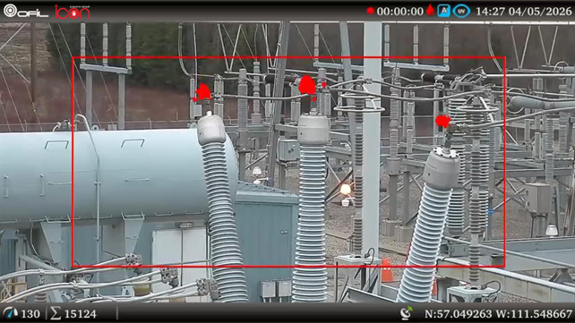
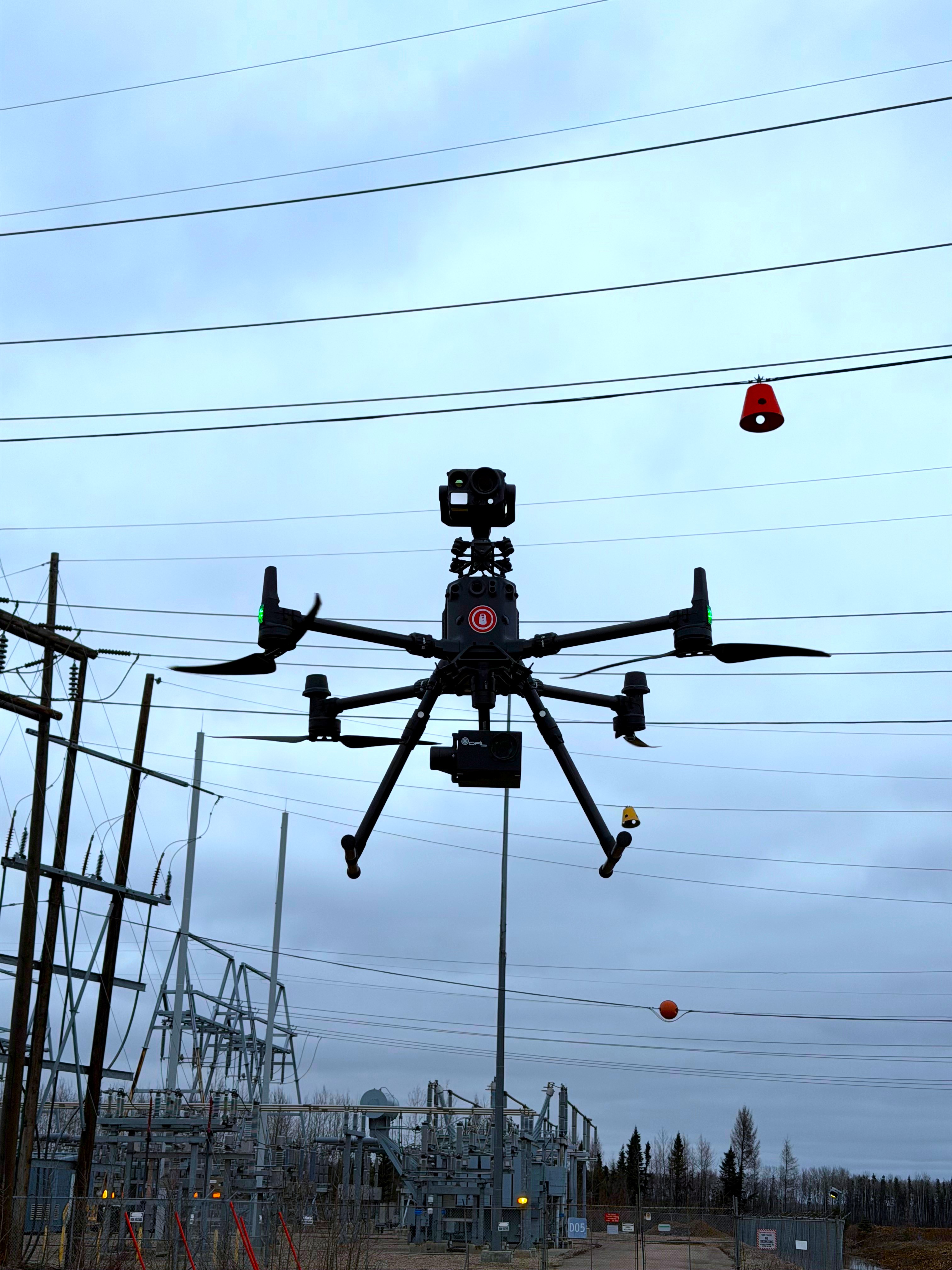
Drone / UAV
Icon Surveys Group delivers cutting-edge Drone and Aerial Data Solutions using the latest generation of RPAS technology to capture, analyze, and deliver precise spatial intelligence for a wide range of applications. Our fleet of advanced drones, equipped with high-resolution photogrammetry sensors, LiDAR payloads, and thermal imaging systems, enables us to collect detailed aerial data safely, efficiently, and with unrivaled accuracy.
- Photogrammetry & Orthomosaic Mapping:
- Aerial LiDAR Scanning:
- Thermal Imaging & Inspections
- Wildlife Sweeps & Environmental Monitoring
- Visual Inspections
- Project Progress Tracking


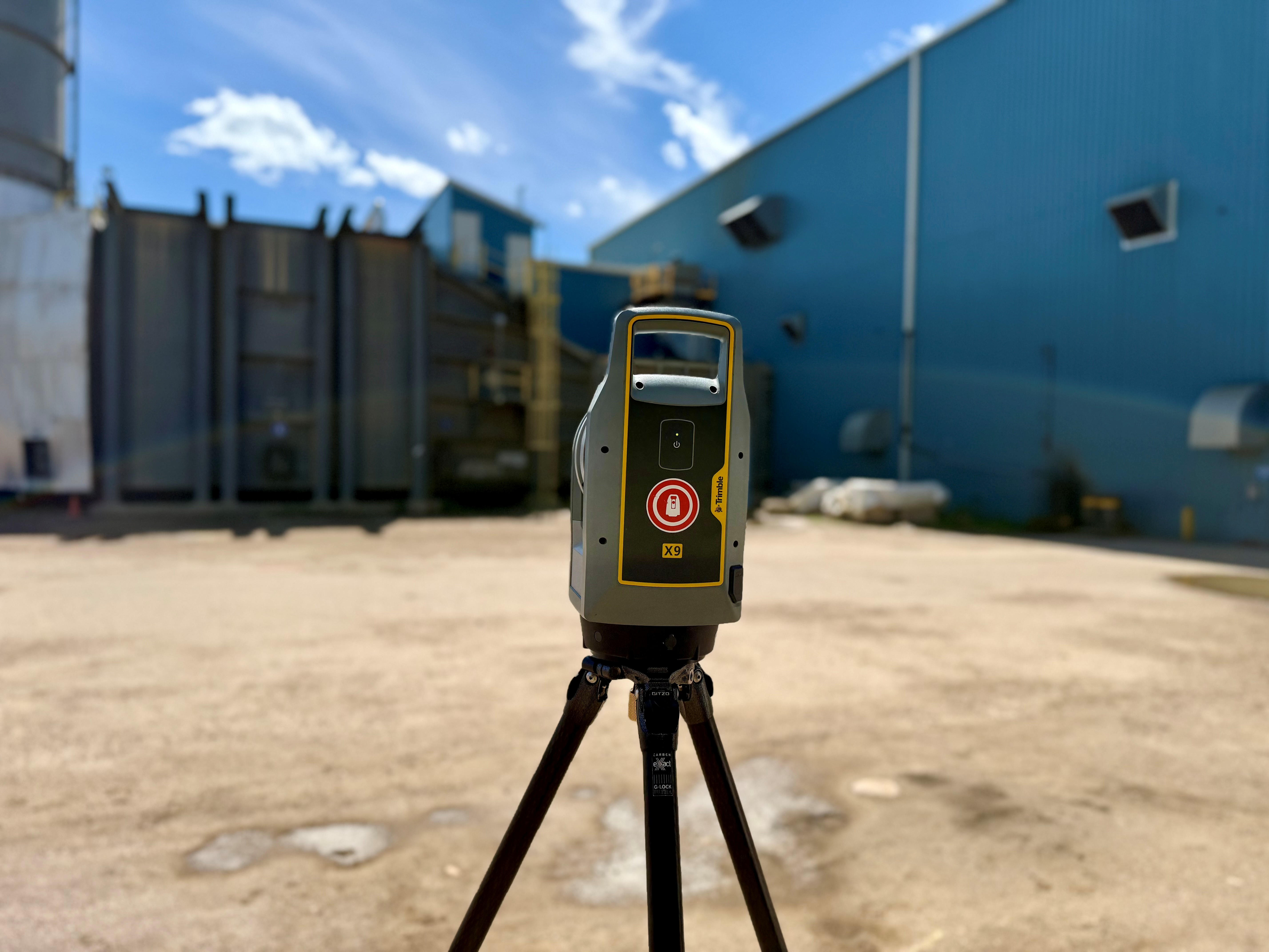
3D Laser Scanning
Terrestrial 3D Laser Scanning
- 3D Laser Scanning